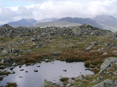
Region
Highlights
Routes
/-3.09807981530821,54.4001336728257,11,0.00,0.00/320x240@2x?access_token=pk.eyJ1IjoicGVha2VyeSIsImEiOiJjampra3Z0bnAxeTVnM3FteHlybHY3b2p1In0.7a5dEa5-995VUv8ceHHNmw)
6 summits • 8.9 km • 1,034 m gain • 2 hr 34 min
2 summits • 10.2 km • 1,090 m gain • 2 hr 47 min
2 summits • 15.6 km • 1,593 m gain • 4 hr 36 min
1 summit • 10.1 km • 683 m gain • 2 hr 51 min
1 summit • 10.6 km • 704 m gain • 3 hr 7 min
1 summit • 14.1 km • 941 m gain • 4 hr 16 min
1 summit • 14.4 km • 1,372 m gain • 4 hr 17 min
1 summit • 14.6 km • 829 m gain • 4 hr 42 min
1 summit • 16.6 km • 935 m gain • 4 hr 32 min
1 summit • 18.4 km • 1,319 m gain • 5 hr 54 min
1 summit • 20.2 km • 1,290 m gain • 6 hr 8 min
1 summit • 23.4 km • 2,368 m gain • 5 hr 31 min
Latest summits

"From Tilberthwaite with Susan. Descent via Steel Edge from Wetherlam. Apologies for lack of map and photos - forgot to take phone! Fear not the route was very pleasant and will feature again." — johnandsue4fun • Jun 16, 2022
"Short afternoon outing up Wetherlam via Steel Edge and down Wetherlam Edge to traverse Birk Fell and so back to the car at Tilberthwaite. Beautiful weather - sunny on the right side and freezing on the wrong side! Susan going well." — johnandsue4fun • Mar 1, 2022
"5/12/2021. Wetherlam to The Old Man via Swirl How and the ridge southwards to Coniston Old Man. Lovely December day with snow and a cold wind sufficient to keep most tourists away. Susan accompanied me as usual." — johnandsue4fun • Dec 5, 2021
"First visit to the hills for many months - COVID-19 lockdown rules in England at last allow visits to the hills. Today we ascended all the Coniston Fells. A good, cold walk. My lifetime partner and wife, Susan, was of course with me." — johnandsue4fun • Apr 13, 2021

"Day 2 of a short break ar Coniston. We walked up into the coppermines valley, then up Red Dell beck to the summit. From the summit we headed NE, down Wetherlam edge, to the lower hills above Tilberthwiate. We dropped down to Tilberthwaite, then walked 2 miles along the valley back to Coniston" — davidlong • Jul 1, 2013
"After 2 days of storms, it was good to get out on the hills again. We started from Coniston village and walked up the path to the coppermines valley. By the first set of old cottages, we cut up NE on an old miners track to the long steady ridge, that took us over Red Gill head to the summit of Wetherlam. After the 2 days of heavy rain, the ground in places was waterlogged and all streams were torrents. After a stop in the summit, where the views of the higher Lake District peaks to the N were good, we set off W over the lower summit of Black Sails and up the steep scramble of Preston Band, to the summit of Swirl How, the highest peak of the day. Here we noticed that bad weather was brewing on surrounding peaks, with rainbows forming between heavy showers. We then made a detour from the route to go out onto 2 subsidiary summits, Great Carrs and Little Carrs. In the col by Great Carrs is the wreckage of a plane that crashed on the peak in bad weather in 1944, we stopped to read the memorial to the airmen. Then the weather took a dramatic turn for the worse, so we hurried on to our final peak for the day, Great How. From here we dropped down very steeply to Levers water, taking great ..." — davidlong • Sep 26, 2012

"Staying at Monk Coniston (HF Guest House). From Coniston with HF party. Up tack on true left bank of Church Beck until the level of Coppermines Valley reached. Then we took track right which gradually ascends hillside. We continued on path until it reaches its maximum height of about 1300'. From this point we went up Lad Stones Ridge to the top of Wetherlam. Continued to Swirl How and Coniston Old Man." — peter43 • Dec 31, 1961
Photos
Awards
Challenges
About peakery awards
Log successful summits on peakery to earn awards:
Peak Badges: Earn a special badge for each unique peak you summit. See all of your badges on your Badges page.

First Ascent Award: Only 1 available per peak. Goes to the first peakery member to log a successful summit of a peak. Snag this award and the peak will forever bear your name.

King of the Mountain Award: Only 1 available per peak. Summit a peak more times than any other member. Beware: this award can be lost!

Summit Steward: Summit a peak at least 5 times to become one of its Summit Stewards. As Steward of a peak, you’re encouraged to keep that peak’s info up-to-date on peakery and spread goodwill on your future climbs up the peak.