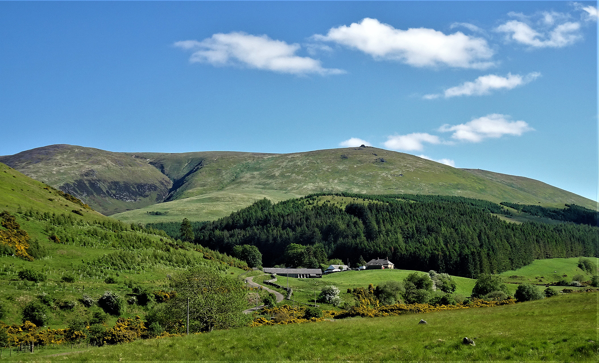
Region
Highlights
Routes
/-2.14580332275386,55.4781681491614,11,0.00,0.00/320x240@2x?access_token=pk.eyJ1IjoicGVha2VyeSIsImEiOiJjampra3Z0bnAxeTVnM3FteHlybHY3b2p1In0.7a5dEa5-995VUv8ceHHNmw)
2 summits • 16.6 km • 572 m gain • 7 hr 45 min
Latest summits

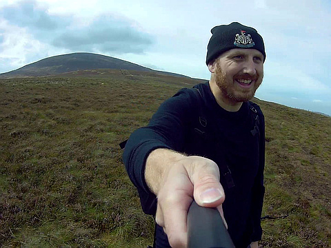
"Spent the night of 27th at Auchope Rigg refuge hut. Ascended through mild wind to Auchope Cairn which was topped in cloud cover. Continued on to Cairn Hill passing aeroplane wreckage. From Cairn Hill followed the stone path to the Cheviot Summit also in cloud cover. Descending from the Cheviot to Scald Hill and then down to Harthope Valley and onto Wooler." — danieltheedrew • Jun 28, 2022
"From Mounthooly, with a College Valley permit. Took the bridleway up to the head of the valley, then up to the border ridge. Then east to the refuge hut, up steeply to the summit of Auchope, then onto Pt.743m on Cairn Hill and to the 777m summit. Then followed the flagstone trail to the summit of The Cheviot. Returned the same way, but descended on a track into the College Valley before the refuge hut. With ALT. Sunny in the morning, but high cloud coming in later, with an increasing SW wind." — marktrengove2 • Jun 15, 2021
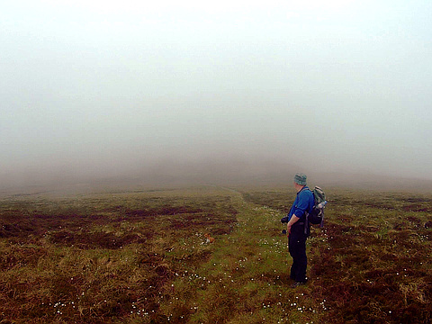
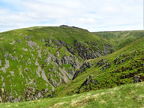
"After bagging Broadhope Hill and Preston Hill, dropped down to Goldscleugh to attempt the Cheviot from a route not very often tackled. We missed the path to the top and ended up trying to heather bash straight up in thigh high heather. The heather forced us off course and eventually we ended up on a spur of the Cheviot known as Woolhope Crag. A cloud bank had descended and made navigation tricky. The heather bashing had tired us and with the fog, we chose to abandon the attempt to the summit and skirted one of Lambden Burn's tributaries to the col between the Cheviot and Scald Hill. Before ascending Scald Hill and returning to the cars on the other side. " — NorthernWayfarer • May 31, 2018

"From Sourhope Farm up Auchope Rig. Took my 6-year-old daughter with me. Stopped at Auchope Mountain Rescue Hut for lunch. Met several Pennine Way walkers between the hut and the summit. Total distance 10.4miles (16.7km) and total time approx. 8 hours including regular breaks and lunch. Weather was cloudy but dry and windy on the tops. Temperature about 13C. " — NorthernWayfarer • May 20, 2018
"Headed up from Sourhope farm along Auchope Rig to the hut. From the hut followed the Pennine Way to the summit and back to the hut for lunch before heading to the Schil. Weather was fine in the morning but windy. It clouded over on our way back from the summit and the rain hit just as we were approaching the Schil. Set off from Sourhope at 9am and were at the hut for lunch by 12:30pm. " — NorthernWayfarer • Sep 21, 2017
"Tried to get my daughter (6) up the top of Cheviot but it was extremely windy. After the wind literally blew her over for the fourth time, I decided to call it a day and head back down. We made it close to the summit of Scald Hill and sheltered in the last grouse hut on the hill (no.1/no.10) before heading back down." — NorthernWayfarer • Sep 3, 2017
"Bagged the Cheviot after a nightmare walk from Comb Fell across peat hags, bog, and clouds of midges. Was starting to lose the light at 8.20pm and came across a father and son team walking up without any equipment. As I had a couple of torches with me because I thought I might lose the light, I waited for them to complete their summit and helped them off the mountain in the dark. We followed the fence up to Scald Hill and then followed another fence down to Langleeford Hope, then followed the track to the cars." — NorthernWayfarer • Aug 23, 2016
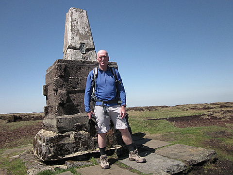
"A hot but breezy day, drove to the roadhead at Harthope Burn nr Langleeford. Walked up onto Scald Hill, with good views across the valley to Hedgehope 714m. Here there are several shooting butts, dropped down slightly and onto the infamous cheviot muddy path. But 10 days of good weather had dried up the mud. We then ascended steeply, onto the summit plateau of Cheviot. here there is now a stone flagged path through the peat, which makes the going to the summit cairn much easier. Good views on the summit plateau, we don't stop long on the summit, but head on SW to Cairn Hill, where we have a late lunch. Look at various options as there are many nearby peaks, but decide on a horseshoe walk option, which takes us S down to Scotsman's Knowe, across some wet peat hags in the col and then up S and then E to Comb Fell. Here the going is very muddy and I regret putting on lightweight boots as I get very wet feet. We then head NE to the col and up the long grassy track to Hedgehope Hill. The weather is still excellent with far reaching views. After a brief stop we head steeply down NW, to Long Crags and Housey Crags and there pick up a good track back to our start point" — davidlong • May 25, 2012
"A cold windy day, drove to the roadhead at Harthope Burn nr Langleeford. Walked up onto Scald Hill, with good views across the valley to Hedgehope 714m. Here there are several shooting butts, dropped down slightly and onto the infamous cheviot muddy path and then up steeply, through some old snow patches onto the summit plateau of Cheviot. here there is now a stone flagged path through the peat and mud, which makes the going to the summit cairn much easier than it used to be. Good views on the summit plateau, but very cold and strong wind. returned by same route." — davidlong • Feb 15, 2012

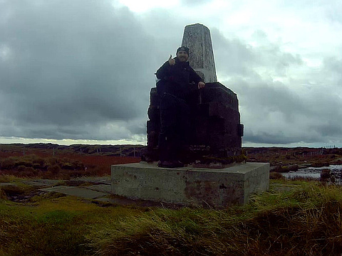
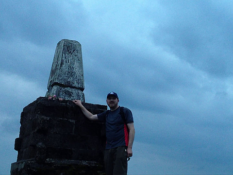
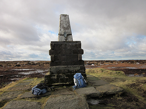
"Solo walk. I parked the car just before the end of the road at Langleeford where other cars were parked. I joined the path to the Cheviot. There was in fact a track as well close by the path in the lower stretches. I followed whichever seemed driest. At parts higher up heather had been cut on the sides of the "path" which had become very boggy. This allowed a drier route but one wondered whether this will just lead eventually to an even wider boggy part. I reached Scald Hill. The path was becoming very boggy indeed. I overtook about 20 people. The summit plateau of the Cheviot is extremely boggy and a path of stone slabs has been laid down. I reached the summit of the Cheviot where there is a trig point sitting on a concrete plinth. I continued to Cairn Hill, Comb Fell, Hedgehope Hill, and down to Langleeford. Dry and mild." — peter43 • Oct 12, 2008
Photos
Awards
Challenges
About peakery awards
Log successful summits on peakery to earn awards:
Peak Badges: Earn a special badge for each unique peak you summit. See all of your badges on your Badges page.

First Ascent Award: Only 1 available per peak. Goes to the first peakery member to log a successful summit of a peak. Snag this award and the peak will forever bear your name.

King of the Mountain Award: Only 1 available per peak. Summit a peak more times than any other member. Beware: this award can be lost!

Summit Steward: Summit a peak at least 5 times to become one of its Summit Stewards. As Steward of a peak, you’re encouraged to keep that peak’s info up-to-date on peakery and spread goodwill on your future climbs up the peak.