Region
Highlights
Routes
/114.124583,22.410166,11,0.00,0.00/320x240@2x?access_token=pk.eyJ1IjoicGVha2VyeSIsImEiOiJjampra3Z0bnAxeTVnM3FteHlybHY3b2p1In0.7a5dEa5-995VUv8ceHHNmw)
2 summits • 8.0 km • 429 m gain • 1 hr 58 min
1 summit • 31.3 km • 1,492 m gain • 5 hr 36 min
1 summit • 38.0 km • 1,717 m gain • 6 hr 16 min
Latest summits

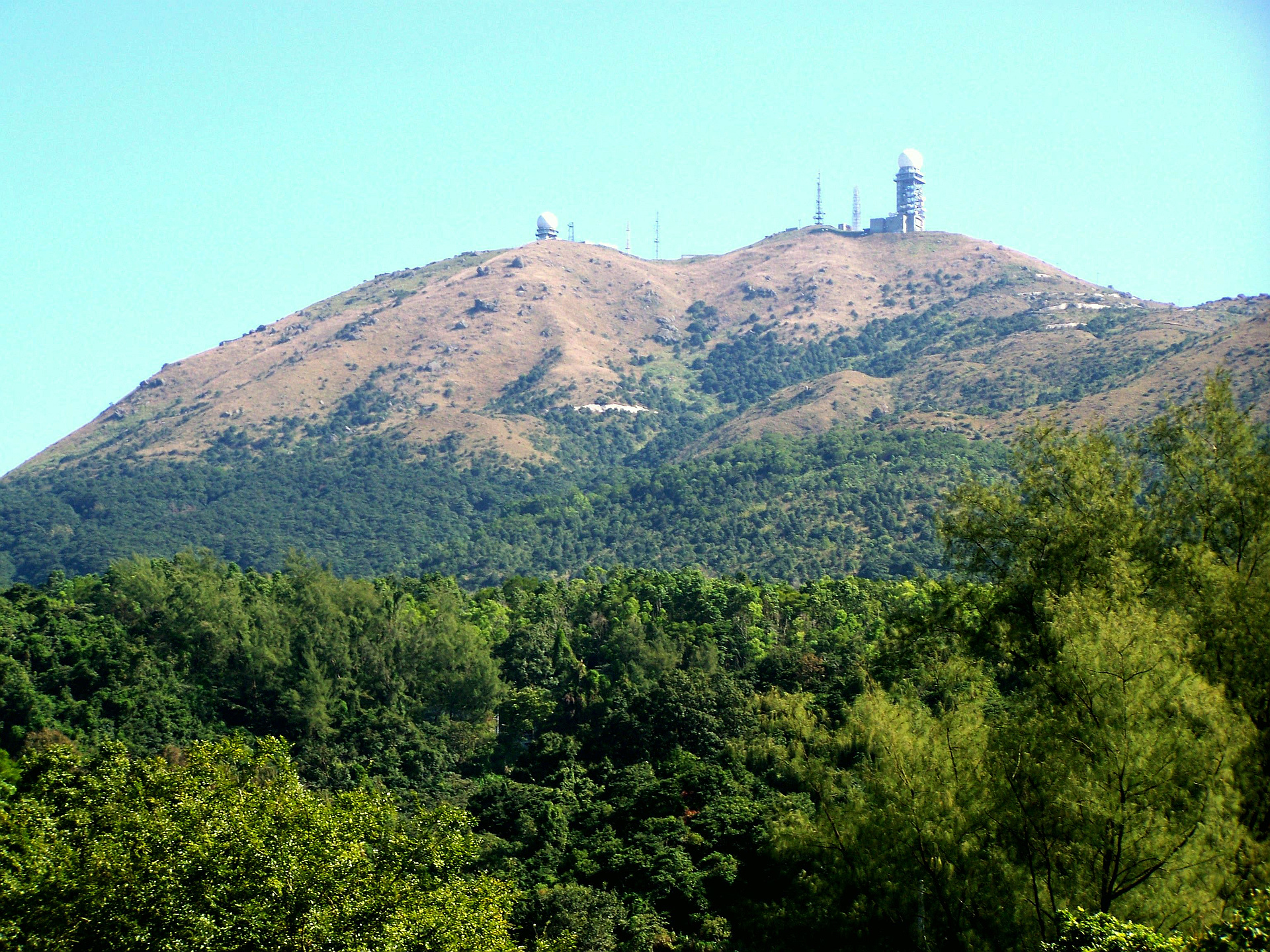
"This was a great morning when the G12s are in mock exams. I drove to the higher carpark on Tai Mo Shan at 700m and walked up the MacLehose trail, which is a road, to the near summit of Hong Kong's number 1, Tai Mo Shan. You can't reach the summit as it is occupied by a PLA listening//spying station which only flies the Chinese flag with no HK symbols at all. Pictures are not allowed so I took several. I was last here 21 years ago having ascended the fine West ridge so this ascent via the Southern approach is quite dull in comparison, yet efficient. The weather was not too hot and it was quite misty/hazey at first but as time passed the mist lifted a bit and views down to Tsuen Wan, Tsing Yi and HK Island were clearer. I messed about a lot with the DSLR and got some better pictures. The light meter over compensates for the haze so I needed to overexpose by two stops to get better pics. From TMS I dropped off the road SE and followed a reasonable path to Wo Yang Shan, which is reasonable summit at 767 m and jammed with granite boulders on the summit which involved some scrambling - I guess these are granite bombs thrown out when TMS last erupted. I then eventually found the path cont..." — billsmith • Mar 15, 2023
Photos
Awards
Challenges
About peakery awards
Log successful summits on peakery to earn awards:
Peak Badges: Earn a special badge for each unique peak you summit. See all of your badges on your Badges page.

First Ascent Award: Only 1 available per peak. Goes to the first peakery member to log a successful summit of a peak. Snag this award and the peak will forever bear your name.

King of the Mountain Award: Only 1 available per peak. Summit a peak more times than any other member. Beware: this award can be lost!

Summit Steward: Summit a peak at least 5 times to become one of its Summit Stewards. As Steward of a peak, you’re encouraged to keep that peak’s info up-to-date on peakery and spread goodwill on your future climbs up the peak.