no info yet
no info yet
no info yet
no info yet
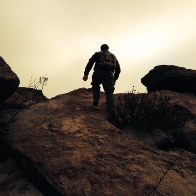
Couldn't determine an actual "trail" to follow in attaining this peak, so we made our own. We took the Minne-Lotte Trail from Mentryville Park to where it dead ends beyond the picnic bench. Crossed the creek to the north and switchbacked up the shale-y hillside using animal track. At the oak on the western tip of the rise we turned east and ascended up the hill through the man-high sagebrush following animal track. At the top of the hill there was an ancient barbed wire fence with a semi-worn trail on the other side looking as if it were coming up out of Wickham Cyn. We followed the trail over the hilltop and there was Sand Rock Peak looming above us. We scrambled across the small depression separating us from the peak and then ascended from the backside to the summit. Even with Santa Clarita Valley spreading away beneath us there was still an unnerving sense of remoteness at the summit.
There is what appears to be a higher peak along a ridge line to the south, between Sand Rock and Oat Mountain. Does anyone know why it is not documented as one of the Santa Susanna Peaks? It is certainly higher than Sand Rock, but definitely does not top Rocky Peak. Is it only a shoulder of Oat Mountain?
no info yet
no info yet


