Region
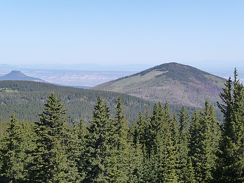
Highlights
Routes
/-106.405149841309,36.0594102200502,11,0.00,0.00/320x240@2x?access_token=pk.eyJ1IjoicGVha2VyeSIsImEiOiJjampra3Z0bnAxeTVnM3FteHlybHY3b2p1In0.7a5dEa5-995VUv8ceHHNmw)
3 summits • 5.7 mi • 1,339 ft gain • 2 hr 59 min
2 summits • 5.6 mi • 866 ft gain • 4 hr 1 min
1 summit • 9.9 mi • 1,836 ft gain
Latest summits

"Get on FR-144 in Espanola and take it to mile marker (MM) 28 (FR-144 has signed mile markers). At MM-28 make an immediate right onto FR-144DI. Drive down FR-144DI (or walk if you lack a high clearance/4WD vehicle) for exactly .9 mile to coordinates: 36.0331944, -106.4055556. This is the trailhead. You should see an opening between some large rocks and a fire ring. The trail is not so obvious in the beginning but once you enter the fir tree forest later it will become very obvious. You will pass a gate in the fence at 36.0344722, -106.4044167. If you read the trip reports by Phil and Richard you will see they also discovered the trail - on the return trip from Polvadera, which is exactly what happened to me. I do not know the full extent of the trail but the section I walked was great. In any case its much better and faster than bushwhacking.
There is log at the summit in a small plastic jar. I provided a small notebook I happened to be carrying since the current log was full. I had to cram it into the small plastic jar so if someone could carry in a larger container that would be great. Another pencil or pen would be great too as there's only one pencil.
The road, ..." — fredbrown585 • Jun 7, 2017
"I left the house at 4:45 AM, on July 19, 2012, with my dog Daisy, and headed north to hike Polvadera Peak, in the Jemez Mountains. The peak has an elevation of 11,232 feet. I drove to the town of Espanola, New Mexico and headed north on highway 84/285. Just north of Fairview road I turned west on forest road 144 and drove 27 miles, for about an hour, on a fairly well maintained dirt road. I hiked Chicoma Mountain in the same area at the end of May and knew that I did not need my 4WD, so I took my other car. It was a little difficult in a few places because of rain washout and it might be a good idea to have 4WD. I parked at the closest point on the road from the peak. My GPS said 2.5 miles as the crow flies. I started hiking at 7:45 AM at an elevation of about 10,800 feet. Because it rained yesterday, it was a crisp fresh morning, pleasantly cool. I headed through the woods and crossed a small boulder field. I gained elevation of only about 125 feet and then started a descent. I bushwhacked, crossed meadows then found a trail. Someone is really maintaining this hidden trail because there were hundreds of cut logs to clear the trail and culverts dug to keep water flow off the tra..." — Phil-Robinson • Jul 19, 2012
Photos
Awards
About peakery awards
Log successful summits on peakery to earn awards:
Peak Badges: Earn a special badge for each unique peak you summit. See all of your badges on your Badges page.

First Ascent Award: Only 1 available per peak. Goes to the first peakery member to log a successful summit of a peak. Snag this award and the peak will forever bear your name.

King of the Mountain Award: Only 1 available per peak. Summit a peak more times than any other member. Beware: this award can be lost!

Summit Steward: Summit a peak at least 5 times to become one of its Summit Stewards. As Steward of a peak, you’re encouraged to keep that peak’s info up-to-date on peakery and spread goodwill on your future climbs up the peak.