Region
Highlights
Routes
/-115.235713685731,50.7663871010073,11,0.00,0.00/320x240@2x?access_token=pk.eyJ1IjoicGVha2VyeSIsImEiOiJjampra3Z0bnAxeTVnM3FteHlybHY3b2p1In0.7a5dEa5-995VUv8ceHHNmw)
5 summits • 5.7 km • 713 m gain • 3 hr 23 min
1 summit • 12.5 km • 1,849 m gain • 10 hr 45 min
1 summit • 13.7 km • 1,238 m gain • 7 hr 18 min
1 summit • 14.0 km • 1,533 m gain • 6 hr 35 min
1 summit • 8.9 km • 1,198 m gain • 6 hr 28 min
Latest summits
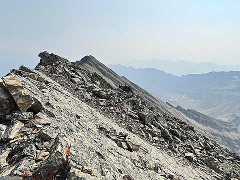
"Kent Ridge North Outlier and North Peak to Mt. Inflexible. Hot. Smoky.
The Kent Ridge peaks were straight forward, the fun begins traversing to Inflexible. Care was needed down climbing loose terrain that I would also consider “delicate”… don’t trust a single hold! I felt route finding was only a slight challenge, mostly because I was happy with my decisions. I did have few short backtracks after being cliffed out. I don’t think this mountain isn’t climbed often, so any significant trails aren’t likely from people traffic. The summit register at Inflexible was out there in 1994. I didn’t count, but there was maybe only a couple dozen names in there. To the North, there is another peak that looked like it could be taller. So I decided to go for it just in case it’s the true high point. I think it is. However, getting there was tricky. A little down climbing, a little scrambling, and some scree bashing. I tried to stick to the ridge but it was notched. More fun came with the descent of the west face. It looks gnarly from a distance, and it’s gnarly close up. if you’re not on super steep slab, you’re on moderately steep slab with loose gravel. I don’t think there’s an establis..." — ivo • Sep 3, 2022

"Went with Simon. We got lucky with a good crust and didn't even bring the snowshoes. We also found the better trail on the way up after some steeper bushwhacking. Totally worth the effort for those views and the perspective. Highly recommended." — leigh-annewebster • Apr 30, 2022
"Used Spirko's descent route as our ascent and we liked it enough to go back down it as well. No bushwhacking and little scree bashing. No summit pics as the clouds cleared after we had left the summit." — BertB • Oct 16, 2021

"Plan was to see if we could traverse to inflexible, however on traverse to Kent ridge we were able to point release the snow and decided this was as far we could go. Consistent (every 5 min) avalanches from north-east facing upper elevations, many going to valley bottom. " — ken_hercules • May 12, 2019

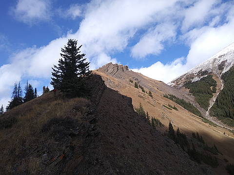
"The trail through the forest is tight with branches touching shoulders and knees most the way. This left me quite wet (even with different layers)for the final half and made the wind gust at top just a bit colder. Still a good day out! " — Randy • Sep 7, 2015
Awards
About peakery awards
Log successful summits on peakery to earn awards:
Peak Badges: Earn a special badge for each unique peak you summit. See all of your badges on your Badges page.

First Ascent Award: Only 1 available per peak. Goes to the first peakery member to log a successful summit of a peak. Snag this award and the peak will forever bear your name.

King of the Mountain Award: Only 1 available per peak. Summit a peak more times than any other member. Beware: this award can be lost!

Summit Steward: Summit a peak at least 5 times to become one of its Summit Stewards. As Steward of a peak, you’re encouraged to keep that peak’s info up-to-date on peakery and spread goodwill on your future climbs up the peak.