Region
Most climbed route
Highlights
Routes
/-71.2740843567812,43.7437780251747,11,0.00,0.00/320x240@2x?access_token=pk.eyJ1IjoicGVha2VyeSIsImEiOiJjampra3Z0bnAxeTVnM3FteHlybHY3b2p1In0.7a5dEa5-995VUv8ceHHNmw)
1 summit • 12.6 mi • 2,029 ft gain • 5 hr 51 min
Latest summits
"Beautiful weather. Nice crisp air, leaves still colorful, and ice starting to form on the leaves. Ground is covered in leaves so finding stable footing was often hard but other than that, very easy hike." — HikingMomMC • Nov 1, 2023

"We meandered around the Ossipee Range checking out a bunch of trails. Eventually landed on Shaw. The late fall colors were spectacular. Tons of burnt yellows and oranges. Leaves cover the foot paths." — Alohabuffy • Oct 22, 2022

"Hiked a loop with Kurt starting by Castle in the clouds. Went up to Roberts and curled around back and across a mostly flat trail. It started out below freezing, but sunny all day, the ground was frozen and there was some light snow on the ground over by Mount Shaw." — mattgardner • Nov 20, 2021

"Redlining plus peaks. Cold Spring to Faraway Connector. Left on Faraway Mt. Trail and up Oak Ridge Cutoff. Right on High Ridge to Mt. Shaw. Then to Black Snout Trail (Black Snout peak) and out to Turtleback Mt. Trail. Right on TBM back to High Ridge. Left on High Ridge to Oak Ridge Cutoff back down to Faraway Connector and Cold Spring for the finish. 57 degrees and cloudy at start. partly sunny and 66 at finish.
" — GreggC • Oct 11, 2021
"This was me and my dad's first hike, boy was it a doozy. The trail was not well marked and we almost got lost a few times. Thanks to all trails we made it to the summit in one piece. My dad did not look so happy once we hit the summit. Also we heard from other hikers that there was a bear near the trail a few miles down. That is always fun on your first hike. Never the less I had a blast and I keep hiking. My dad on the other hand was a one and done hiking mountains. " — MadHobbyist • Aug 31, 2021
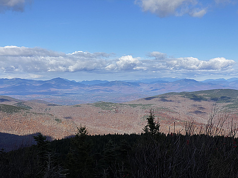
"Beautiful bright blue skies providing stunning views north from the summit of Mt Shaw. Snow-capped Mt Washington right in the center. You can literally pick out 20-30 white mountain peaks. Descended across Black Snout and Big Ball mountains. 2-3 inches of snow on the upper half, even in October." — Alohabuffy • Oct 31, 2020

"Planned on taking the Mt. Shaw trail first but then took the Tate Mtn. Trail instead. Met a young man who said that Black Snout was just "a bump"! Signage was nonexistent, would've been lost without my map. Wasn't sure where the peak was for Big Ball, looks like there are two on the map. Headed to Black Snout where I saw the first signage. Trail up very very steep. Once I came out of the forest the peak was surrounded by a carriage road so a nice easy climb to Mt. Shaw, and then an easy descent to the Mt. Shaw Trail, which was also very steep and lacking in signage, though there was the occasional red blaze on trees or rocks. Once I hit the carriage road there it was smooth sailing back to my car." — NHClimber • Sep 29, 2019

"More of a “choose-your-own-adventure” type climb than I was expecting, as I ended up bushwhacking nearly half of it (though ostensibly trailed to the top, there are flagged and blazed side trails everywhere). Even more surprising: the last bit is on a switch-backed jeep road. Felt more like Colorado then NH, but fun nevertheless!" — robertocampo • Nov 4, 2017

"Mt Shaw trailhead on Rt 171 is a mess with the logging activity. Follow herd path to the left leaving the parking area and stay by the stream until you pick up the red blazes about 1/3 mile in then you'll be fine Met two folks who knew the area and that did help. Very nice day with a few very scattered flurries.. just enough to tell you winter is on the way. Limited views due to overcast but still a beautiful area and hike over Shaw and Black Snout" — goshen-bagger • Nov 5, 2016

"I had difficulty finding the trail...so much so that I did a 2 mile loop and found myself back at the 'parking lot'....the logging has completely ruined the entrance to the trail via the entrance on shaw trail next to field's brook. Once finally on the trail, I went to Tate, Black Snout and then Mount Shaw. Here is where I made a big mistake and took a right at the first red dot from Mount Shaw instead of coming back to Black Snout by accident....I then got completely lost and would up 15 miles from where I came in....luckily I found a nice man to drive me back to the entrance on Mountain Road. The foliage was beautiful....probably just one week until peak leaf peeping at the top of Black Snout.
WARNING: the trail is not marked well at the start (due to the logging)....stay close to the brook and eventually you will find the trail." — shay-shay • Oct 3, 2016
Photos
Awards
Challenges
About peakery awards
Log successful summits on peakery to earn awards:
Peak Badges: Earn a special badge for each unique peak you summit. See all of your badges on your Badges page.

First Ascent Award: Only 1 available per peak. Goes to the first peakery member to log a successful summit of a peak. Snag this award and the peak will forever bear your name.

King of the Mountain Award: Only 1 available per peak. Summit a peak more times than any other member. Beware: this award can be lost!

Summit Steward: Summit a peak at least 5 times to become one of its Summit Stewards. As Steward of a peak, you’re encouraged to keep that peak’s info up-to-date on peakery and spread goodwill on your future climbs up the peak.