Region
Highlights
Routes
/152.670983076506,-28.2205370971743,11,0.00,0.00/320x240@2x?access_token=pk.eyJ1IjoicGVha2VyeSIsImEiOiJjampra3Z0bnAxeTVnM3FteHlybHY3b2p1In0.7a5dEa5-995VUv8ceHHNmw)
4 summits • 6.9 km • 701 m gain • 4 hr 14 min
1 summit • 15.9 km • 645 m gain • 4 hr 24 min
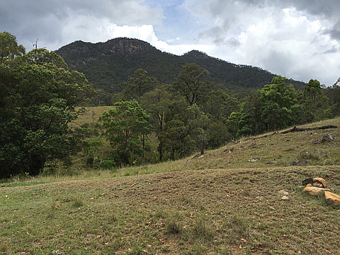
Latest summits

"14 members of Happy Hikers, led by Diana Kueh and me, ascended from camping area to the north peak, then across to the south peak, then descended southerly to Waterfall Creek Rd and back to the cars. This was a hike for slower walkers. Split into two groups as some were faster than the others. One person did not want to cross the ledge on the way down to the saddle, and one accompanied her back to the cars so only 12 completed the full circuit." — donizen • Apr 27, 2019
"Left camping area t 6.10 am. Went earlier than my companions due to an injury slowing me down. Arrived at the top about 8.10 and the others arrived about 30 minutes later. Track is fairly obvious to the top of the first peak. It starts near the southern end of the camping area on Waterfall Creek Rd. Some parts are steep but not too difficult. Track from first peak (western) to second and main peak (eastern) is stepp down and steep up. To return to the cars, go back down the obvious track on the south ridge to the road then it is about 3.5 km hike along the dirt road. Would advise not doing this after heavy rain. Also a nice rockpool and small waterfall if you follow the creek near the start of the track up the mountain." — donizen • Nov 26, 2016
Photos
Awards
Challenges
About peakery awards
Log successful summits on peakery to earn awards:
Peak Badges: Earn a special badge for each unique peak you summit. See all of your badges on your Badges page.

First Ascent Award: Only 1 available per peak. Goes to the first peakery member to log a successful summit of a peak. Snag this award and the peak will forever bear your name.

King of the Mountain Award: Only 1 available per peak. Summit a peak more times than any other member. Beware: this award can be lost!

Summit Steward: Summit a peak at least 5 times to become one of its Summit Stewards. As Steward of a peak, you’re encouraged to keep that peak’s info up-to-date on peakery and spread goodwill on your future climbs up the peak.