Region
Highlights
Routes
/-121.835659943687,37.5459715272235,11,0.00,0.00/320x240@2x?access_token=pk.eyJ1IjoicGVha2VyeSIsImEiOiJjampra3Z0bnAxeTVnM3FteHlybHY3b2p1In0.7a5dEa5-995VUv8ceHHNmw)
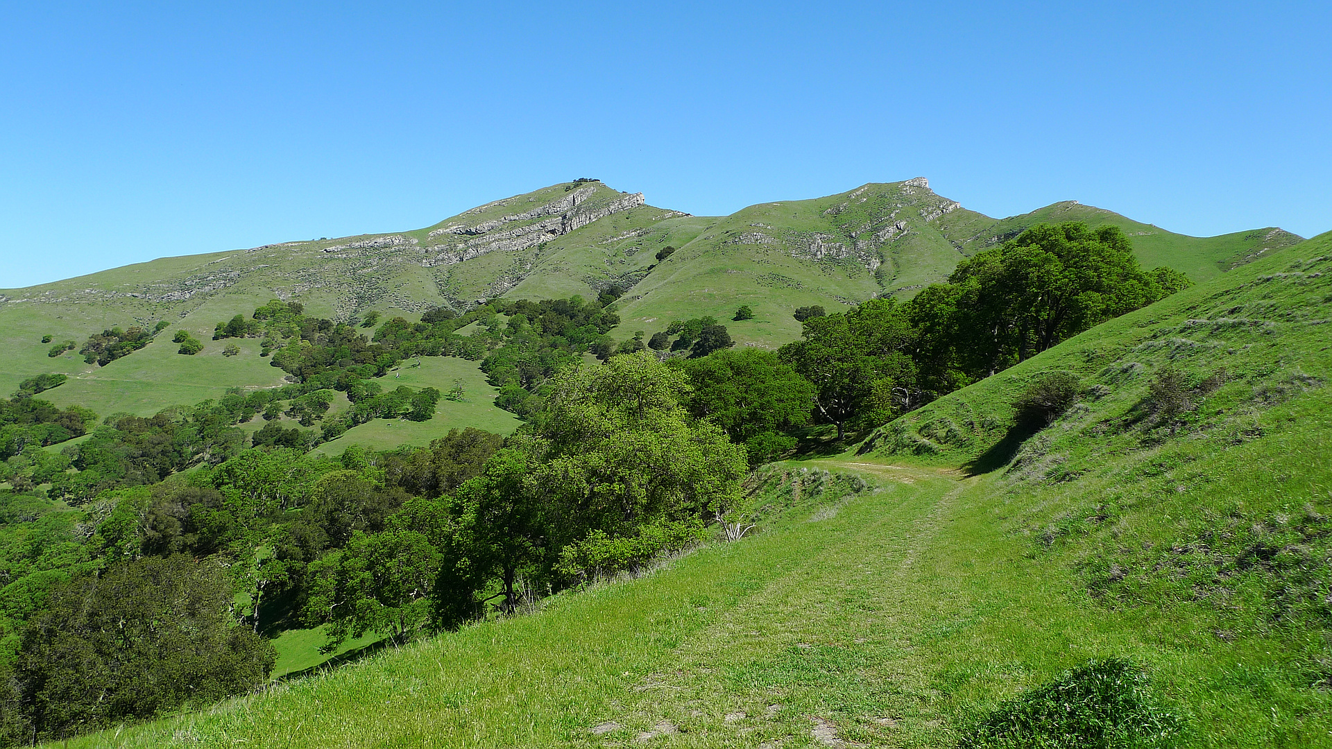
4 summits • 6.1 mi • 1,202 ft gain • 2 hr 57 min
1 summit • 13.1 mi • 2,822 ft gain • 5 hr 31 min
1 summit • 5.2 mi • 1,071 ft gain • 3 hr 50 min
1 summit • 4.8 mi • 1,021 ft gain • 2 hr 19 min
1 summit • 6.0 mi • 1,303 ft gain • 1 hr 51 min
Latest summits

"Ascended on the first break from a long drought. Mixed wind and rain throughout the day. The trail is largely wide, unpaved roads which are pretty easy to hike on. The segment leading up from the loop trail to the peak was narrow and more challenging, but sheltered from the wind. We took an alternative route back down which had a really dynamic weather condition.
Make sure to first visit the visitor center (on the next road south) to get a parking permit.
GPX file is wrong; recording cut out as we were descending back onto the loop trail. From there, we re-did the steep section heading clockwise toward the bench and completed the loop before returning to the base." — HolyBejeesus • Sep 18, 2022
"Was a great day for a hike. Little chilly start, but warmed up. Cows are docile (stayed away, even with the little ones). Easy route. Some signs are knocked down, but trail is pretty clear. Had a great hike with a great friend." — colleenmarie512 • Mar 14, 2021

"This was a fun trip. I took the use trail up the West Peak, then hiked cross country over to the East Peak and continued east along the ridge before rejoining the trail. This route involved lots of steep up and downs and even a little cl. 3 scrambling to get through the cliff bands. Also hiked up Flag Hill and Sams Peak." — klotito • Feb 17, 2020

"Finally knocked off another peak in the SF Bay Area Classic Peak Challenge. Smoldering hot, mid-90s, absurdly dry and everything prickly. Didn't see a soul the entire time in this vast wilderness. The thousands of cow patties make it clear: this is cow country. The short climbers' path to the summit starts at the bench on the northwest side of Maguire Peak (the west of the 2 peaks). You really can't miss the bench. Shortest way to get there is counter-clockwise. Tried to follow a 2nd climbers' path down the southwest slope but it was too overgrown with prickly plants so retraced my steps and then completed the loop. Note extremely limited parking on Welch Creek Rd, and high prowl (parked on scattered smashed car glass), so don't leave anything of value in your car. Maybe even keep your window down? Cows might get in then, so not sure." — scott • Sep 12, 2019

"No trail damage to my knowledge, but navigation was less than straightforward on this one. 1. The trailhead starts at a signed fire road, so avoid the many pulloffs that look like trailheads on the main road. 2. Stay on the fire road after 0.2 mile (there's a much smaller use trail that bears right that I believe is signed as Maguire Peaks, but it just leads you back to the road). 3. The fire road circles around Maguire Peak; I would recommend going counterclockwise on it until you reach a bench (it's the shorter route). 4. Once you've reached the bench, there's an obvious use trail that wends its way to the summit. 5. Avoid getting between a mama cow and her calf; they'll start to charge if you're not careful! Maguire Peak was the only mountain I've climbed where I thought I might be killed by a cow :)
The above is from RobertOcampo . Thanks for the response to my questions. It is spot on. Beautiful day today, get the map at the visitors center and its pretty good, 7 to 8 to 9 to summit, counter clockwise just like he said. MUD MUD MUD , holy hell it was muddy and there was cow patties all over (first world problems) There is a small peak called Flag Hill that's a 2.6 mile RT a..." — puddlepirate • Dec 24, 2016

"Nice quite trail away from the crowds. I can't find any photos from this trip, but hike it a lot. Here's one of my favorites with my friend Nans Kunz taken Dec. 14, 2013 with our wives. We typically hike counter clockwise and hit the summit as a side trip. Limited parking and it's getting more crowded over the last few years." — mj3920 • Nov 19, 2011
Photos
Awards
Challenges
About peakery awards
Log successful summits on peakery to earn awards:
Peak Badges: Earn a special badge for each unique peak you summit. See all of your badges on your Badges page.

First Ascent Award: Only 1 available per peak. Goes to the first peakery member to log a successful summit of a peak. Snag this award and the peak will forever bear your name.

King of the Mountain Award: Only 1 available per peak. Summit a peak more times than any other member. Beware: this award can be lost!

Summit Steward: Summit a peak at least 5 times to become one of its Summit Stewards. As Steward of a peak, you’re encouraged to keep that peak’s info up-to-date on peakery and spread goodwill on your future climbs up the peak.