Highlights
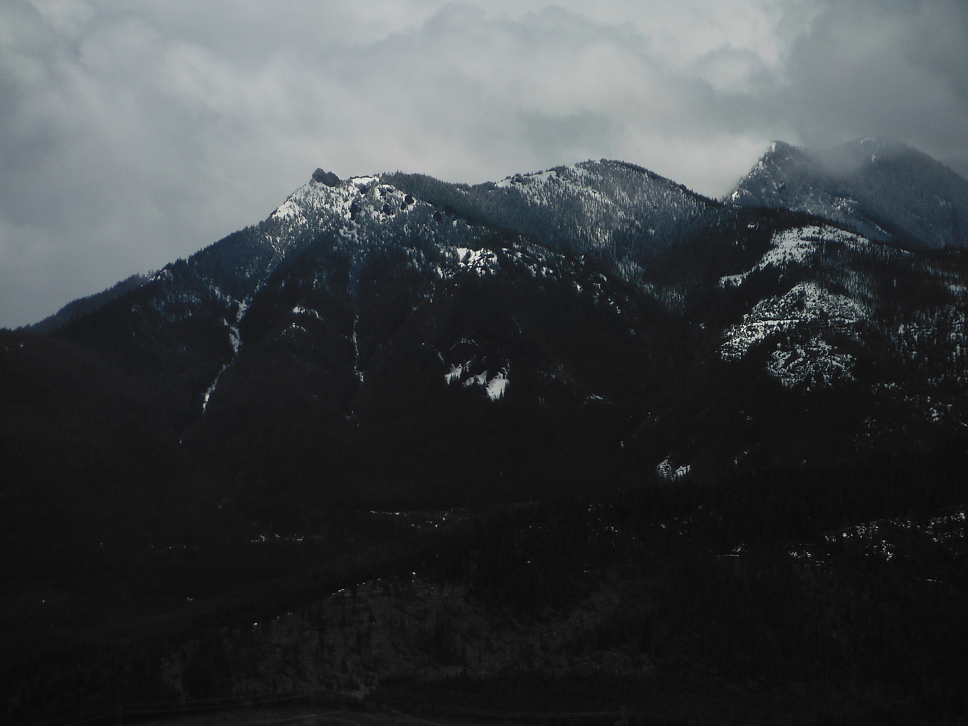
Latest summits
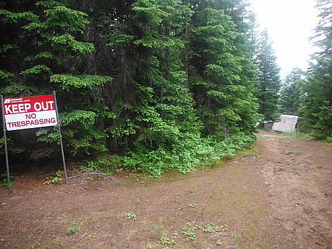
"I should start with a warning that this route requires either crossing through private property, or some serious bushwhacking. I first attempted to approach from the northeast but could not find access to the road near tucker creek from exit 71. It may be possible to get there from exit 74 but i instead decided to continue west on Road 41. Just after crossing Cole Creek I turned left, passing some nice camp sites on the creek, and continued south to a fork in the road 3.5 miles from where the pavement ends.
Green Trails map #240 for Easton shows a road to the east that continues to the old lookout site after nearly intersecting the trail in a saddle between Goat Peak and the peak to its SW. This road has several washouts making it impassable without high clearance, which meant I was walking from there.
Stay on the main road, to the right, at the first junction. The next turnoff,also to the left is gated and posted "No Tresspassing, Private Property". I'm fairly certain now that this is the road on the map, but I continued to the right for another mile or so until reaching a small lake/big pond with a nice little campsite. It was here that I realized I was heading south an..." — Jeb • Jul 20, 2012
Photos
Awards
About peakery awards
Log successful summits on peakery to earn awards:
Peak Badges: Earn a special badge for each unique peak you summit. See all of your badges on your Badges page.

First Ascent Award: Only 1 available per peak. Goes to the first peakery member to log a successful summit of a peak. Snag this award and the peak will forever bear your name.

King of the Mountain Award: Only 1 available per peak. Summit a peak more times than any other member. Beware: this award can be lost!

Summit Steward: Summit a peak at least 5 times to become one of its Summit Stewards. As Steward of a peak, you’re encouraged to keep that peak’s info up-to-date on peakery and spread goodwill on your future climbs up the peak.