🏔 #SummitSeason Encore 🏔
.
I decided to commit to the full @uofucampusrec #7summitschallenge 🥵 After today I've done 26,808 ft since Aug 24th, and have 2,192 ft left to complete the equivalent of Mt Everest's elevation ✊🏽
.
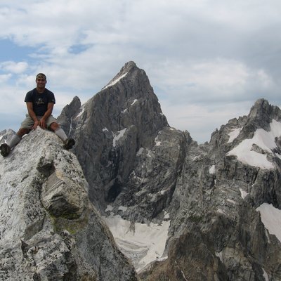
Elevation: Sunrise Peak - 11,275 ft, Dromedary Peak - 11,107 ft.
Trailhead: Mill B South.
Route: Broads Fork.
Start Time: 8:30am.
Time to Summit: 4.5 hrs to Sunrise Peak, 5.5 hrs to Dromedary Peak.
Total Time: Approximately 8.5 hrs.
Distance to Summit: Approximately 5.39 miles to Sunrise Peak, 6 miles to Dromedary Peak.
Total Distance: 11.46 miles.
Elevation Gain: 6,842 ft.
Notes: This was my first loop hike - from Broads Fork, to the summits, and to Lake Blanche. The approach was mostly simple until I reached the scree field below the Cottonwood ridgeline. Scree, snow and grass do not mix well. Once on the ridge I tried to stay on it and probably didn't drop more than about ten feet below it.
After reaching the saddle between Sunrise and Dromedary, some information said I would need to drop 50 feet down into Little Cottonwood Canyon, but I found a class 4 climb that seemed manageable. After that I followed climbers paths and looked for access points back onto the ridge until I reached the summit of Dromedary Peak.
To be expected, since I was doing a loop, I didn't know the way down. So I used the Hiking Project app to find the trail. But I would say stay ridge as you descend from Dromedary until you find a line that aligns with the lakes to the west of Lake Blanche.
.
🚮 @keepnaturewild #wildkeepers and @cottonwoodcanyonsfoundation #packitoututah2020 Trash Haul: 16.2 lbs - bandana, cloth mask, knitted glove, coffee cup, candy wrappers, tissues/wipes/paper towels, other micro trash, and a whole pumpkin that was sitting at the trailhead all day! 🚮
.
Shout-out to summitpost.org for the helpful information on these two peaks and to the Hiking Project app for the descent help.
.
#wyldwalkers
Other peaks climbed on this trip
