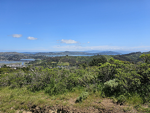
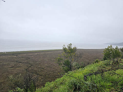
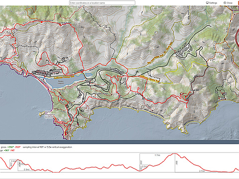
"The Marin 25". Explore the wild coastal hills of Marin County, California. Climb the 25 peaks in Marin all with publicly-accessible trails or paths to the summits. Most of these coastal peaks are connected by an incredible trail network stretching from the Golden Gate Bridge and the Marin Headlands in the south to Mt Tamalpais State Park and Point Reyes National Seashore in the north.
Highest peak
Mount Tamalpais East Peak
2,572 ft / 783 m
Most prominent peak
Big Rock Ridge
1,287 ft / 392 m prom
Most summited peak
Mount Tamalpais East Peak
140 summits
Most difficult peak
Big Rock Ridge
Class 1
Difficulty breakdown
Class 1/2 8 peaks
Highlights
- Climb the hills of the Marin Headlands surrounded by rugged coastline, WWII bunkers, bobcats, and coyotes
- Take a short path to the highpoint of the actual point in Point Reyes (and be sure to check out the lighthouse).
- Hike the vast trail network around Mt Tam, the highest peak in Marin 2,572 ft
- Explore the open-meadow peaks and ridges of northern Marin in several California State Parks
- Take a ferry to Angel Island and wind your way around the trails up to the panoramic summit of Mt Livermore 788 ft
Latest summits
"My wife and I wanted to check out a new trailhead that we heard about. As we were driving up to the TH we climbed about 500 feet. We were laughing about it because my wife was excited for the free climb and I was grumbling about how the car was eating into my elevation gain. I'm sure she would love to start here again...but I know the TH has likely seen the last of us! " — jeffreybossaller • Apr 30, 2023
"The day started off with nice clear skies. By the time we got an hour into our hike it began to pour. It lasted about 25 minutes but the damage was done. We were soaked. Fortunately my wife planned for this and brought a waterproof jacket. I did not. Oh well. At least I had time to dry off a little before the hike ended. " — jeffreybossaller • Mar 11, 2023
"I started my hike at 2:00pm and got backl to the car at 7:30pm. I hiked most of the day and ran for about an hour. It was a gorgeous day with perfect temperatures for a long hike. I watched part of the Sunset on Hawk Hill and finished it on Lower Hawk Hill. This was close to the longest hike I have done in the Marin Headlands. I got back to the car after dark and then decided to shed the backpack and do the last two peaks (Peak 197 and Peak 360) after dark with a headlight on. This completes my 50 Peak Challenge and I really appreciate the effort that was put in to getting this challenge set up. It was one of the coolest things I have done." — jeffreybossaller • Feb 25, 2023

"Great loop trailrun up Yolanda to the short steep Buddha trail, then up and over supeaks to the flat summit of Baldy. Down other side and back on Yolanda a tad after sunset. Days are so short right now, barely had light to type this. " — scott • Dec 7, 2022

"Quick run from East Garrison to West Garrison to bday cake/cannon sendoff. Hit Mount Livermore and Point Stuart Hill en route. Incredible views of SF and the bay; reflection from water so intense could feel its heat." — scott • Nov 13, 2022