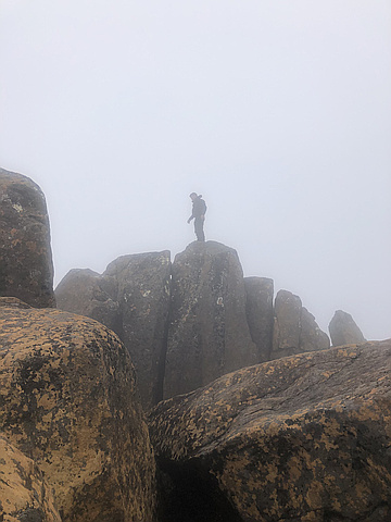
Highest peak
Mount Kosciuszko
7,309 ft / 2,227 m
Most prominent peak
Mount Kosciuszko
7,309 ft / 2,228 m prom
Most summited peak
Mount Kosciuszko
72 summits
Most difficult peak
no info yet
Difficulty breakdown
no info yet
Highlights
Latest summits

"15km return hike, took all of 11 hours with lunch and a brief stop at the summit. Climb was pretty intense at some points and summit was, as usual, covered in clouds with only occasional visibility breaks. Best view was from the helipad 500 from the summit. Creek with seemingly drinkable water reaches up to 3.5km from the parking lot, only drank 3L comfortably the whole day. Epic summit scramble, awesome experience, would be stunning on a clear day. " — MacRogers2087 • Sep 25, 2021

"It was a Cold Gorgeous Trek taking 6.5 hour's, probably could've done it a little quicker but was enjoying the scenery and taking picture's.. Amazing walk that everyone should try atleast once..
I will definitely be going back to do it again in the Summer to see the Bloom's and even Winter to see the Snow.." — Geemurdoch • May 9, 2021
"First chance to get back to this beautiful area in the Cradle Mountain National park.
Rain ☔️ Rain ☔️ Leeches - more rain - great climb for Aus 🇦🇺 day weekend.
Second go after an ambitious attempt in 2 days in Sept 2018 Heavy snow back then meant only one of us summited. This time we were better organised and planned for summer.
4 of us set out on the Saturday after lunch in pouring rain, reaching the new Pelion Hut late evening after multiple stops to get rid of leeches. (Tip: Hand sanitizer works a treat over a cigarette lighter!) Set up tents out on the landing area for campers. Had dinner and slept. Up early on Aus day, left tents and took day packs to summit. Up and back, the small summit marker took a while to find but as soon as we took our pics we were off back to the tent. Dinner in the hut again, sleep. A warmer day for the return back to
our cars." — Chefinthecity • Jan 26, 2020

"We left this as our final State8 summit, given it is the highest in Australia. It is also one of the easier climbs. We did cheat a bit, by catching the chair lift half way up, but on the way down, the chair lift had closed, so we had to walk the whole way, which was great to do. (We had just done Bimberi Peak in ACT the day before, so decided to sleep in before commencing this walk). There was still snow at the summit, despite it being November. Many people were climbing the mountain throughout the day, even on our way down, by which time it was getting quite late in the day. Thankfully the sun doesn't set until late also. " — tarawood • Nov 17, 2019
"This was the hardest of the State8 challenge (and the hardest hike I've ever done), not only because it is extremely remote and you need a proper 4WD to get there, but also because you need to travel on unmade and unmarked roads. We relied on our GPS to navigate to the camp site, but also to climb to the summit and return again (there were no suitable topographic maps of this area and no track to follow either). The terrain was quite difficult to climb - very small pebble like footing meant we all fell over multiple times, despite using hiking poles. Spinifex is everywhere and I was picking in out of the hands and knees for about 2 weeks afterwards. We contacted the NT park ranger beforehand, who was kind enough to give us lots of info, including a GPX track he'd done previously, and advise us the return trip would take around 8 hours (lol!). It actually took 2 of us 16 hours return and the other 2 team members 26 hours return. So we were walking well into the night, as we weren't carrying out tents with us. It was both physically and mentally challenging, with many false summits. I've never been more relieved to see our camp site at the end! We had enough water, but if the tempera..." — tarawood • Sep 22, 2019