
Region
Highlights
Routes
3 climbs • 6.5 mi • 999 ft gain • 4 hr 11 min
1 climb • 12.8 mi • 2,088 ft gain • 7 hr 56 min
Latest climbs
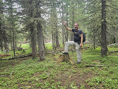
"Amy and I are preparing to hike Kilimanjaro at the end of the summer, and besides many cardio hikes together, this is a preparatory hike for that event. We traveled to a beautiful area sandwiched between the Truchas Peaks to the south, and Wheeler Peak to the north. This mountainous region is a beautiful green, forested, wildflower filled, area with of lots of 11K peaks. I hiked this area with my daughter Christina 13 years ago but I needed 3 extra peaks that I did not get then. We met at Calvary Church at 5:30 AM then headed north. Between Taos and Española on Highway 68, we turned east on Highway 75 near the town of Embudo, that road turns into 518 South traveling about 45 minutes east from the Highway 68 turn-off, then we turned north on dirt Forest Road 76, following a beautiful little stream. The first 10 miles are great for a passenger car. The last 2 miles are very, very rough and need a 4WD. After 12 miles on the dirt road, and about 30 minutes, we parked at a saddle below the peak. It was a beautiful, crisp, partly cloud covered, cool morning. The elevation was about 11,140 feet. Most all of the trees in the area were blue spruce. The entire area was beautiful, green and l..." — Phil-Robinson • Jul 19, 2025

"Amy and I had to hike Cerro Olla twice today. See other entry for today to see pictures, GPS trek, Google Earth 3D image and trip report.
https://peakery.com/cerro-olla-new-mexico/summits/511026/" — Phil-Robinson • Jul 19, 2025
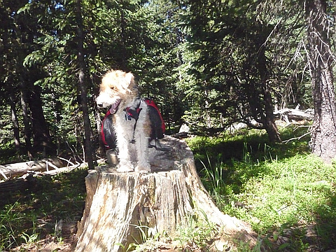
"One of the things that I enjoy the most about peak bagging is seeing beautiful parts of New Mexico that I otherwise might never see. My 15 year old daughter Christina and I hiked two peaks in an area that I had never been before. The two peaks are sandwiched between the Wheeler Peak mountains to the north, highest peaks in NM, and the Truchas Peak mountains to the south, the second highest range. We hiked Cerro Vista, elevation 11,939 and further to the south on the same ridge Cerro Olla, elevation 11,932. We left the house 5:00 AM on Wednesday, July 25, 2012 and headed north to between Taos and Espanola. We turned east on highway 580 from the town of Embudo and continued until the road changed to highway 75. We traveled about a half hour from Embudo and came to Forest Road 76. We turned north on the well maintained dirt road. It is a beautiful green lush valley with a little stream flowing through it and lots of great camping spots all the way up. The first 10 miles are great for a passenger car. The last 2 miles are very, very rough and need a 4WD. After 12 miles on the dirt road, and about 30 minutes, we parked at a saddle below the peak. The distance to the peak was about tw..." — Phil-Robinson • Jul 25, 2012
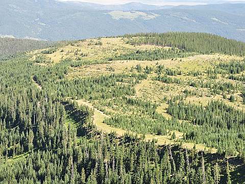
"Head to Tres Ritos and drive approx 9.5M either park car and head straight up or if have a 4wd drive up fairly rough slow track as high as you can. There is plenty of dirtbiker and quad riders here so be aware, they are all pretty friendly. Climb over fence or open gate, follow quad trail about half a mile,the track seems to fork to the right slightly as if it is an old track, if you are ok about it, you can b-line straight up throught the trees, steep but faster, then you will hit the open meadows , you then will see the quad trail again when almost to the top. Walk through a open meadow with great views in all directions, then continue to top in heavy forest it is hard to find a top , but if you have time you can head over saddle and bag Cerro Vista as well." — adameco • Aug 8, 2011
Photos
Awards


About peakery awards
Log climbs on peakery to earn awards:

Peak Badges: Earn a special badge for each unique peak you summit. See all of your badges on your Badges page.

First Ascent Award: Only 1 available per peak. Goes to the first peakery member to log a successful summit of a peak. Snag this award and the peak will forever bear your name.

King of the Mountain Award: Only 1 available per peak. Summit a peak more times than any other member. Beware: this award can be lost!

Summit Steward: Summit a peak at least 5 times to become one of its Summit Stewards. As Steward of a peak, you’re encouraged to keep that peak’s info up-to-date on peakery and spread goodwill on your future climbs up the peak.