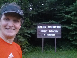
Manitoba peaks
Most prominent peak
no info yet
Manitoba summits
First Ascent Awards
9 of 325 peaks 2%
Top climbing months
May 40%
July 20%
June 20%
Top ranges
Manitoba mountains highlights
Latest summits
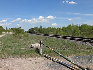
"Parked the car at the junction of Road 47E and the railroad tracks that run approx ENE. This location is approx 1 mile south of the junction of Road 47E &Mile 70N Road. When taking Road 47E heading south, it will come to a blockade at the railroad tracks, making it not possible to go any further south. Hiked in to Bunker Hill from this parking spot, by following an unnamed trail that runs parallel to the railroad tracks. You can walk the trail or walk the tracks (beware of trains!) heading approx ENE. After approx 3/4 km, the ridge, which is basically the trail, will rise, and it's assumed this is Bunker Hill. From the top of Bunker Hill, you can see down into the adjoining gun-target practice area. There is a sharp drop-off with sandy terrain. Note there is a gun-target practice range immediately beside the trail, with plenty of sign posts marking its boundaries. Do not cross into the practice range!
Sandy terrain, forests, trees, adequate trail part way, bushwacking part way.
Beware of deer ticks in May, June & maybe July that can carry Lyme Disease.
Rated extra easy. The height of the "hill" is extremely low, and is about 3/4 km walk in from the road." — dianejohnstone • May 23, 2016
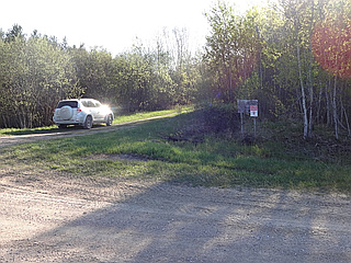
"Parked the car at the corner of Mile Road 82N and Road 39E. Entered the Mars Hill Wildlife Management area on foot (no cars permitted) at this corner by walking in on what would be the extension of Mile Road 82N, heading west.Then at the first trail intersection, turned right, heading north on the winding unmarked trails. There is a maze of trails which we navigated by printing a Google maps close-up with the natural terrain view. Heading north overall, the trail eventually comes to an end by looping in a curve and heading back south. According to Peakery.com, Wolverine Hill is located at this loop. There is no hill, just flat land with very, very slight slopes up and down. The walk from the car to the "hill" is estimated 1.5 km one way. Sand trails, fir forests, grass. Rated extra easy." — dianejohnstone • May 15, 2016

"Parked the car at the corner of North Drive and the entry to the north-running road to "Folk Festival Quiet Camping" area. Hiked northwards to Griffiths Hill first along this north-running road to the end, then on trails, through aspen forest. Not having a good map, several trails in the area were tried, until finding a good map in the hut at the summit, and then realizing we were at the summit. We then realized that Griffiths Hill has a lookout point on the summit. The red sign-posted Chickadee Trail would have been the best approach from the Quiet Camping loop road, and this was used on the hike back. Only a very gentle uphill slope, barely noticeable, exists while approaching summit. Rated extra easy. About 1 km hike north, from North Drive to summit, one way." — dianejohnstone • May 8, 2016
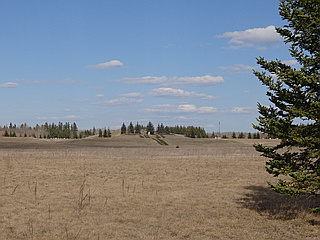
"Parked car on North Drive and hiked in from the south-west. Ascended the south-west face under excellent conditions. The hike from car to the summit is 1 km or a little less, and is open flat land." — dianejohnstone • May 1, 2016
"While driving East with daughter...saw a huge moose...spooky Lookout Tower on a very quiet evening. Low tire pressure sensor went off as we left and managed to make it down dirt road for 40km back to Grandview. Camped in the park. Got tire repair for $35 next morning and on our way at 8:30am." — alexjoseph • Jun 25, 2015