
Region
Most climbed route
Highlights
Routes
/-118.128261566162,34.3836793711145,11,0.00,0.00/320x240@2x?access_token=pk.eyJ1IjoicGVha2VyeSIsImEiOiJjampra3Z0bnAxeTVnM3FteHlybHY3b2p1In0.7a5dEa5-995VUv8ceHHNmw)
1 summit • 12.5 mi • 1,608 ft gain • 4 hr 56 min • Class 1
Latest summits
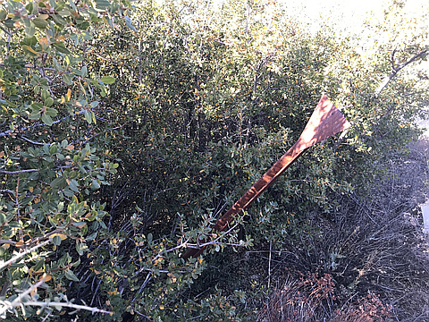
"From Mill Creek Summit, I picked up the PCT going west, which goes parallel to Forest Road 3N17. The PCT is rather smooth and sandy, which is welcomed relief to my feet as opposed to the paved forest road. I stayed on the PCT which went around 7 miles and to the opposite side of Little Mount Gleason. Here, the PCT intersects an overgrown forest road. I turned left on the forest road and started walking east toward the summit towers. There are radio towers and a metal summit marker in the bushes at the highest point.
The overgrown dirt road continues beyond the high point to another bump to the east. On this summit sits the “Gleason” benchmark. Instead of backtracking from there, I followed a use trail down the ridge which led back to 3N17. This saved me at least a mile of backtracking. I later picked up the PCT at a crossing point and returned to The Mill Creek Summit parking area right before it got dark." — MikeTeeples • Nov 3, 2019
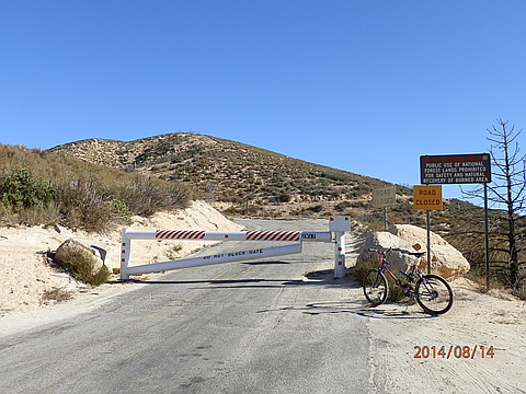
"6.2 miles 1-way w/1,275' gain, 200' loss from Mill Creek Summit Picnic Area on Angeles Forest Road (TH:4915'), via Mt Gleason Road 3N17 and peak access dirt road to antenna facility on the Point Most easily done as a bike-n-hike since roads are good!" — BradStemm • Aug 14, 2014
Photos
Awards
About peakery awards
Log successful summits on peakery to earn awards:
Peak Badges: Earn a special badge for each unique peak you summit. See all of your badges on your Badges page.

First Ascent Award: Only 1 available per peak. Goes to the first peakery member to log a successful summit of a peak. Snag this award and the peak will forever bear your name.

King of the Mountain Award: Only 1 available per peak. Summit a peak more times than any other member. Beware: this award can be lost!

Summit Steward: Summit a peak at least 5 times to become one of its Summit Stewards. As Steward of a peak, you’re encouraged to keep that peak’s info up-to-date on peakery and spread goodwill on your future climbs up the peak.