Region
Highlights
Routes
/-121.331858890199,47.4409963017951,11,0.00,0.00/320x240@2x?access_token=pk.eyJ1IjoicGVha2VyeSIsImEiOiJjampra3Z0bnAxeTVnM3FteHlybHY3b2p1In0.7a5dEa5-995VUv8ceHHNmw)
10 summits • 11.2 mi • 3,289 ft gain • 6 hr 27 min
1 summit • 11.6 mi • 4,084 ft gain • 5 hr 37 min
1 summit • 14.8 mi • 4,219 ft gain • 11 hr 20 min
1 summit • 17.3 mi • 5,506 ft gain • 7 hr 12 min
Latest summits

"No appreciable snow (though the grass in the meadows was notably matted down from the last week's storms). Wind was whipping enough at the top to give me a brain-freeze and encourage a hasty retreat. Jed the Peakbagging Pooch accompanied me." — TynanRammGranberg • Oct 19, 2020

"My first summit...stayed at Lila Lake Friday night, and set out around 0630 to climb Alta. Beautiful weather, clear skies, and the sun behind the clouds for most of it kept the heat down (and the breeze). Tons of blueberries along the way, and a really straightforward, non-life-threatening path. Had the place all to myself for an hour before I decided to come back down. Great views of Hibox, Rainier, and so many others. Only about an hour each way from Lila Lake, plus an hour on top." — 3SeaSons • Sep 7, 2019

"from the boys' WTA report
We are the Mountain Goats, Terrence (13) and Nathan (15) and today we climbed Alta Mountain, through Rachel and Lila Lakes.
We didn't get an early start so by 8:30 the upper parking lot was totally full and the lower lot was filling up fast. Tons of cars and people camping along the road on the way up to the trailhead. As soon as we got out of the 4Runner the mosquitoes began attacking. we had cream and spray, but still got a few bites.
The trail starts out very flat for the first 2 1/2 miles or so. Very well maintained and easy to make good time. Pretty soon after the Hibox Mountain cutoff, the trail gets steep and there are some obstacles to get through. Several stream and waterfall crossings, some rocks, a lot of mud and a few downed trees. Nothing major, but good to have decent footwear on this part. We saw lots of people coming down the trail who had been camping the night before up at the lakes. There were several people at Rachel Lake and several thousand mosquitoes. We took a quick brake and headed up to Rampart Ridge - the trail is steeper at this point and you gain pretty good elevation. The top of the ridge has nice views..." — BryHong8 • Jul 13, 2019

"Great summit for a sunny day with views. Took the traditional route via Rachel Lake. The trail was in a good condition. Smooth cruising all the way to the summit. Not many berries but abundance of mushrooms for those interesting in mycology." — Gabigabs • Sep 20, 2014

"Despite getting rained on twice and being surrounded by clouds nearly the entire trip, this was one of my favorite hikes. The dogs and I visited dozens of alpine lakes, saw tons of marmots and hawks, and experienced a unique climate created by converging cloud fronts of precipitation and smoke. We were even lucky enough to spend an hour or two above the clouds on the summit.
We started off under thick clouds from the unofficial trailhead at Rocky Run Creek off NF road 136. I glimpsed a tent through the fog on the way past Lake Lillian and encountered a lone hunter clad in blaze orange on the trail above the lakes. On the way up Rampart Ridge the cloud front from the west poured over the ridge and into the valley below and I could smell occasional pockets of warm smoky air rising up from the east. From the summit we scrambled down the boot path to the east and back into the clouds, continuing along the steep trail to the Rampart Lakes.
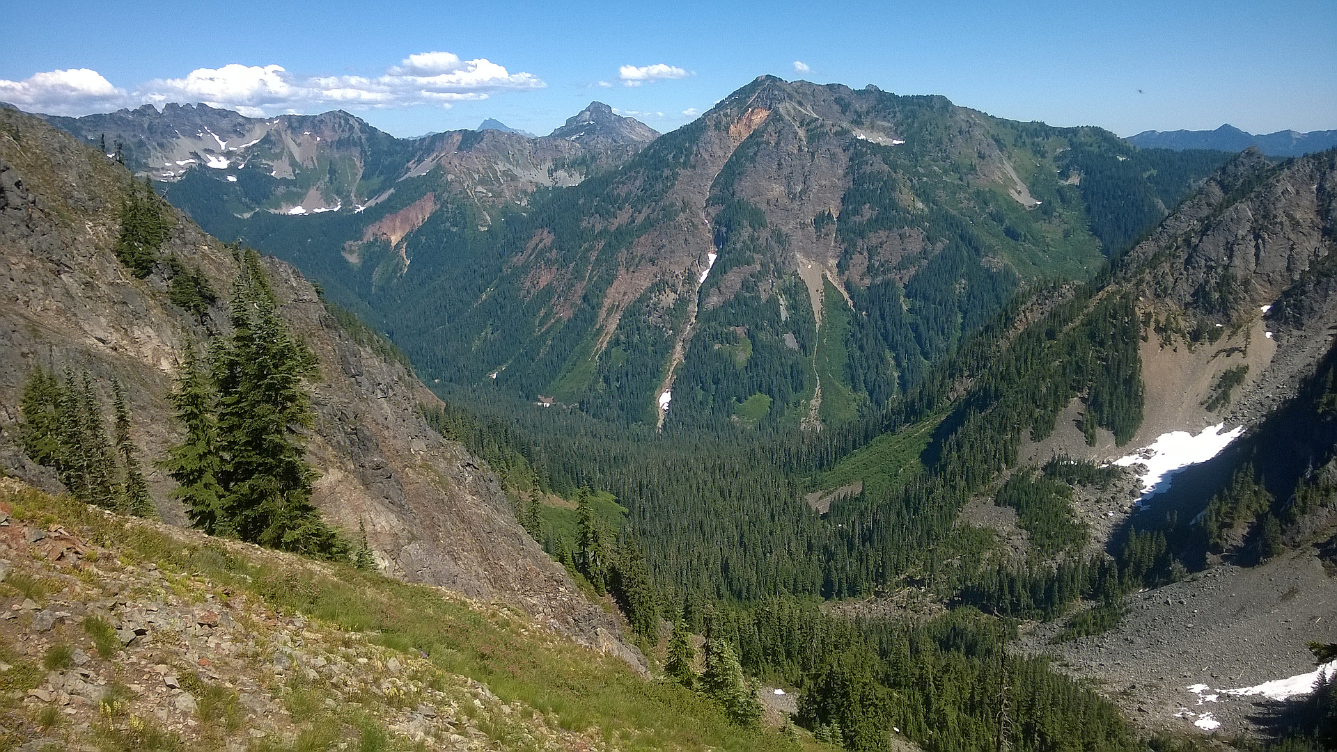
A web of paths weave among the Rampart Lakes on the way to the Rachel Lake, becoming Rachel Lake Trail 1313. From here we headed toward Lake Lila and Alta Mountain. At about 5400' the distinct north-to-south ridge of Alta Mountain became visib..." — Jeb • Sep 22, 2012
"Intended to head up Hibox but decided to abort after getting completely soaked and lost in the shrubbery. Turns out I fell for the classic Hibox mistake of taking the wash trail through the 2nd big clearing instead of the dirt climber's path in the forest AFTER the clearing.
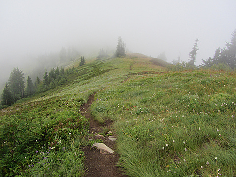
But salvaged the day with a great hike up Alta Mountain. No viz at all above Rachel Lake... cloudy and damp the whole way down the ridge. Couldn't see beyond each false summit so over and over thought I was on top... but after a minute would see a dark mass higher than me swirling in the mists. The most false summits ever! Imagine the views from the top would be epic; I'll just fire up Google Earth and pretend I'm there." — scott • Sep 9, 2012
Photos
Awards
Challenges
About peakery awards
Log successful summits on peakery to earn awards:
Peak Badges: Earn a special badge for each unique peak you summit. See all of your badges on your Badges page.

First Ascent Award: Only 1 available per peak. Goes to the first peakery member to log a successful summit of a peak. Snag this award and the peak will forever bear your name.

King of the Mountain Award: Only 1 available per peak. Summit a peak more times than any other member. Beware: this award can be lost!

Summit Steward: Summit a peak at least 5 times to become one of its Summit Stewards. As Steward of a peak, you’re encouraged to keep that peak’s info up-to-date on peakery and spread goodwill on your future climbs up the peak.