
Region
Highlights
Routes
/-121.700507998466,47.5117181472467,11,0.00,0.00/320x240@2x?access_token=pk.eyJ1IjoicGVha2VyeSIsImEiOiJjampra3Z0bnAxeTVnM3FteHlybHY3b2p1In0.7a5dEa5-995VUv8ceHHNmw)
8 summits • 21.2 mi • 4,078 ft gain • 6 hr 14 min
4 summits • 10.4 mi • 3,856 ft gain • 1 hr 52 min
3 summits • 14.0 mi • 4,561 ft gain • 3 hr 8 min
2 summits • 9.8 mi • 4,165 ft gain • 3 hr 47 min
1 summit • 10.5 mi • 3,933 ft gain • 4 hr 23 min
1 summit • 11.1 mi • 4,071 ft gain • 6 hr 8 min
1 summit • 11.2 mi • 4,173 ft gain • 3 hr 36 min
1 summit • 11.4 mi • 4,132 ft gain • 4 hr 16 min
1 summit • 11.6 mi • 4,457 ft gain • 3 hr 40 min
1 summit • 12.6 mi • 4,237 ft gain • 6 hr 9 min
1 summit • 13.0 mi • 4,521 ft gain • 3 hr 38 min
1 summit • 13.0 mi • 4,902 ft gain • 7 hr 27 min
1 summit • 27.5 mi • 9,272 ft gain • 9 hr 40 min
1 summit • 32.1 mi • 10,383 ft gain • 13 hr 24 min
Latest summits

"Solo hike today and to the TH @ 7:30AM, 3 cars in the lot on a Friday. Kamikaze up is as fun as everyone says, lots of gain. My calves and achilles were feeling it. On the descent (down Teneriffe trail) I found talus on only about 30% of the hike -- a majority of the trail was quite clean. No sweeping landscape photos were possible today, as the smoke finally found it's way here. " — zachmitch • Sep 9, 2022
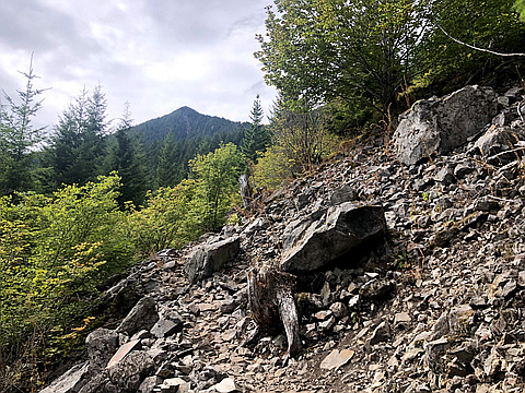
"Solo late afternoon hike up the Kamikaze Route of Mount Tenerife. I have heard how difficult this trail is, so of course, having sumitted most if not all the peaks on the I90 corridor, and many of the HC 100, I decided to attempt this route as a trainer for a solo Enchantments through hike. I have been up Tenerife a couple of times, and outside of this route, and maybe connecting Blowdown, Crater Lake, or Dixie, the mountain no longer has much appeal. The trail up towards the falls, is the usual restored former logging road - boring. Finally, some switchbacks emerge to help traverse a talus field, all the way up to several lookouts for the falls. Sadly the falls were bone dry today, and the rest of the trail was steep, and there are no water sources remaining on this route - FYI - so be prepared. Once the steep, rooty, rocky switchbacks yielded to a rocky ridge, you emerge on a rocky point with a great view and appreciation of the ongoing uphill ridge to climb. The route has you going up a few rocky bits for a few hundred feet, and then yields to forested paths, with ever-emerging daylight as the trees on each side of the ridge tin out as you gain altitude. The trail is mos..." — markhadland • Aug 20, 2020
Photos
Awards
About peakery awards
Log successful summits on peakery to earn awards:
Peak Badges: Earn a special badge for each unique peak you summit. See all of your badges on your Badges page.

First Ascent Award: Only 1 available per peak. Goes to the first peakery member to log a successful summit of a peak. Snag this award and the peak will forever bear your name.

King of the Mountain Award: Only 1 available per peak. Summit a peak more times than any other member. Beware: this award can be lost!

Summit Steward: Summit a peak at least 5 times to become one of its Summit Stewards. As Steward of a peak, you’re encouraged to keep that peak’s info up-to-date on peakery and spread goodwill on your future climbs up the peak.