Region
Highlights
Routes
/18.9272274957247,-33.8839875237821,11,0.00,0.00/320x240@2x?access_token=pk.eyJ1IjoicGVha2VyeSIsImEiOiJjampra3Z0bnAxeTVnM3FteHlybHY3b2p1In0.7a5dEa5-995VUv8ceHHNmw)
9 summits • 8.1 km • 936 m gain • 5 hr 36 min
1 summit • 10.9 km • 916 m gain • 4 hr 2 min
Latest summits
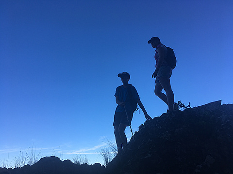
"Start Tokara up B Route to the right towards Joubertskop off trail most of the way some c grade scrambles and thick fynbos to negotiate. Down A route on trail easy but very long and last 20min on steep gravel road not pleasant." — GreenGecko • Dec 19, 2021

"After signing in at the Tokara Winery guard house, we were pointed towards the path. This road leads up to a sunken concrete reservoir where you will be able to find the start of the single track. It is a very easy path to follow, everywhere you might get lost, you will easily be able to find cairns. The path is quite steep and challenging, so fitness is required." — MikeyG • Nov 23, 2019

"Peaked this wonderful mountain in 3 hours, taking another 2 hours to get back to its base.
It required nothing more than some basic path-finding knowledge due to the overgrown nature of parts of the trail, but it's been kindly marked out with cairns at most of the questionable locations. Access to the hike was very easy, with a simple (free) sign-in at the back gates of Tokara Wine Estate, and a short 20min walk (no vehicle access) to the start of the trail, marked quite clearly with a Simonsberg Conservancy sign and submerged concrete reservoir that the security advises to fill up at.
Gear-wise, we went up with the bear-minimum, with nothing other than snacks and water in our backbacks, and simple trail shoes - nothing too high-level required, although I'm sure it will make a lot of the steeper/rockier parts of the hike a lot more manageable. We handled it fine though, with very little struggle - but its important to be prepared for a very steep and unrelenting incline. Fitness is most important on this hike as it never flattens out until you are right on top.
All-in-all, it was a great adventure and to the fellow Peakery's out there living near the Stellenbosch area, it ..." — WadeyB • Nov 16, 2019
"Great hike from Tokara Gates. Easier than expected path, steep in places with lots of tennis ball size loose rocks in the summit gully. Had to use hands in a few places, but never felt really exposed. Started at 06:30 and was back for lunch. Phone Tokara security gates the day beforehand." — dawid_burger • Sep 24, 2019
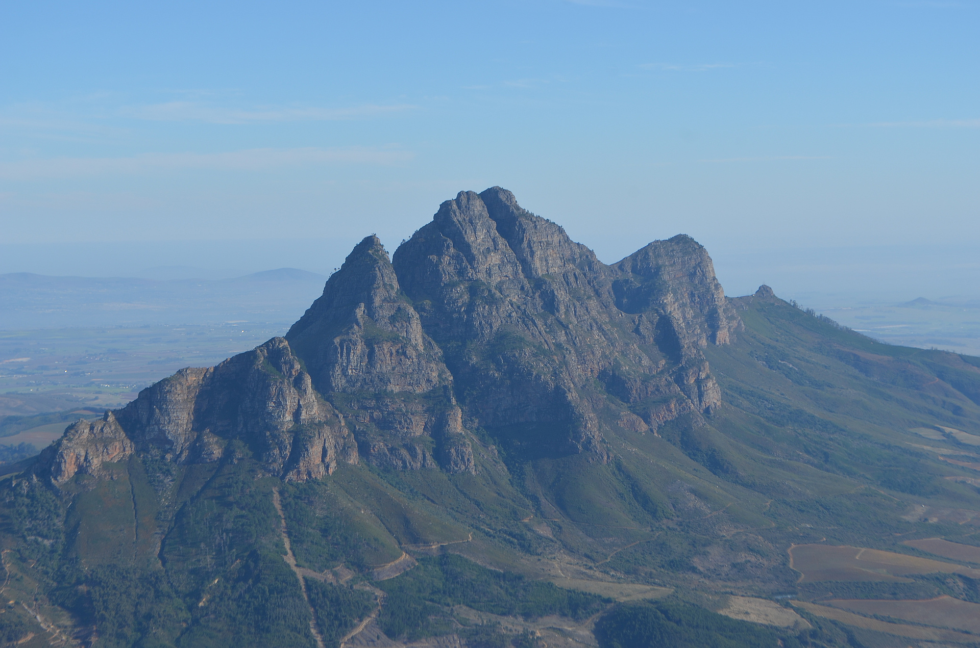
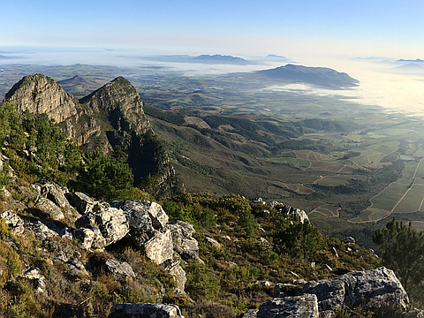
"Clear sping day with the expected south-easter blowing on top though the climb up the usual west side route was protected from the wind. Need to book arrival and ( free ) entrance through Tokara / Thelema security at their gate a day in advance. No entrance if there is cloud cover / weather looming. Kicks off with steep roads through vineyards then onto steeper footpath needing handholds here and there. Midway up there is a short traverse from right ( south ) to left ( north ) of the west face before the last steep and wide gulley that is littered with very loose rocks and pebbles runs south-east to the top. No real exposure or serious scrambling needed. The view from the top is an unsurpassed 360 degree view of the Cape Peninsula, Boland etc." — dawidburger • Sep 24, 2019

"A group of us set out just after sunset to Tokara to start the climb in their vineyards. The hike is essentially riding an elevator up to the mountain summit. I did not enjoy the route that much, as it mostly just straining upwards, without exploring interesting aspects of the mountain. The view from the top is incredible and we found the cave to put our names in the summit log." — Willowskid08 • Nov 11, 2018
"Set off at 06h30 from Tokara Wine Farm on the Helshoogte pass.
Up and down by 13h00.
Tough climb, incredible reward with the 360deg view at the top.
My 6th summit of the berg
Simonsberg Manskoshuis 2007 - 2010
"Noblesse Oblige"" — jacquesleroux • Dec 15, 2016
"I organised the summit with the security at Tokara wine estate during the week before. They only permit hiking from the estate if the weather is good. Hiking is permitted from about 7:30am but the rules are fairly loose. having spoken to them during the week and built some kind of relationship they were fine to let me up as soon it was light.
You receive a kind hand drawn map at the gate and entry is free (last I checked). the route is a concrete path for the first kilometer or so. After you reach a reservoir on the other side of estate you duck into the bush and the fun begins.
the trail is a fairly crazy one. As long as you are not climbing over a cliff, the route is basically strait up in the direction of the summit. Once you reach the cliffs you will find a few switch backs and a traverse until you find yourself looking up the riverbed of a ravine. the trail is basically strait up the riverbed from this point on. One thing I haven't mentioned is that you are quite dependent on cairns from the point at which you reach the cliffs and you may need to stop from time to time just to stay familiar with the trail and the direction in which it is heading.
All in all the route..." — desdeary • Aug 8, 2015
Photos
Awards
Challenges
About peakery awards
Log successful summits on peakery to earn awards:
Peak Badges: Earn a special badge for each unique peak you summit. See all of your badges on your Badges page.

First Ascent Award: Only 1 available per peak. Goes to the first peakery member to log a successful summit of a peak. Snag this award and the peak will forever bear your name.

King of the Mountain Award: Only 1 available per peak. Summit a peak more times than any other member. Beware: this award can be lost!

Summit Steward: Summit a peak at least 5 times to become one of its Summit Stewards. As Steward of a peak, you’re encouraged to keep that peak’s info up-to-date on peakery and spread goodwill on your future climbs up the peak.