Region
Most climbed route
Highlights
Routes
/-115.404832376329,50.5963052688097,11,0.00,0.00/320x240@2x?access_token=pk.eyJ1IjoicGVha2VyeSIsImEiOiJjampra3Z0bnAxeTVnM3FteHlybHY3b2p1In0.7a5dEa5-995VUv8ceHHNmw)
1 summit • 13.3 km • 1,674 m gain • 9 hr 39 min
Latest summits

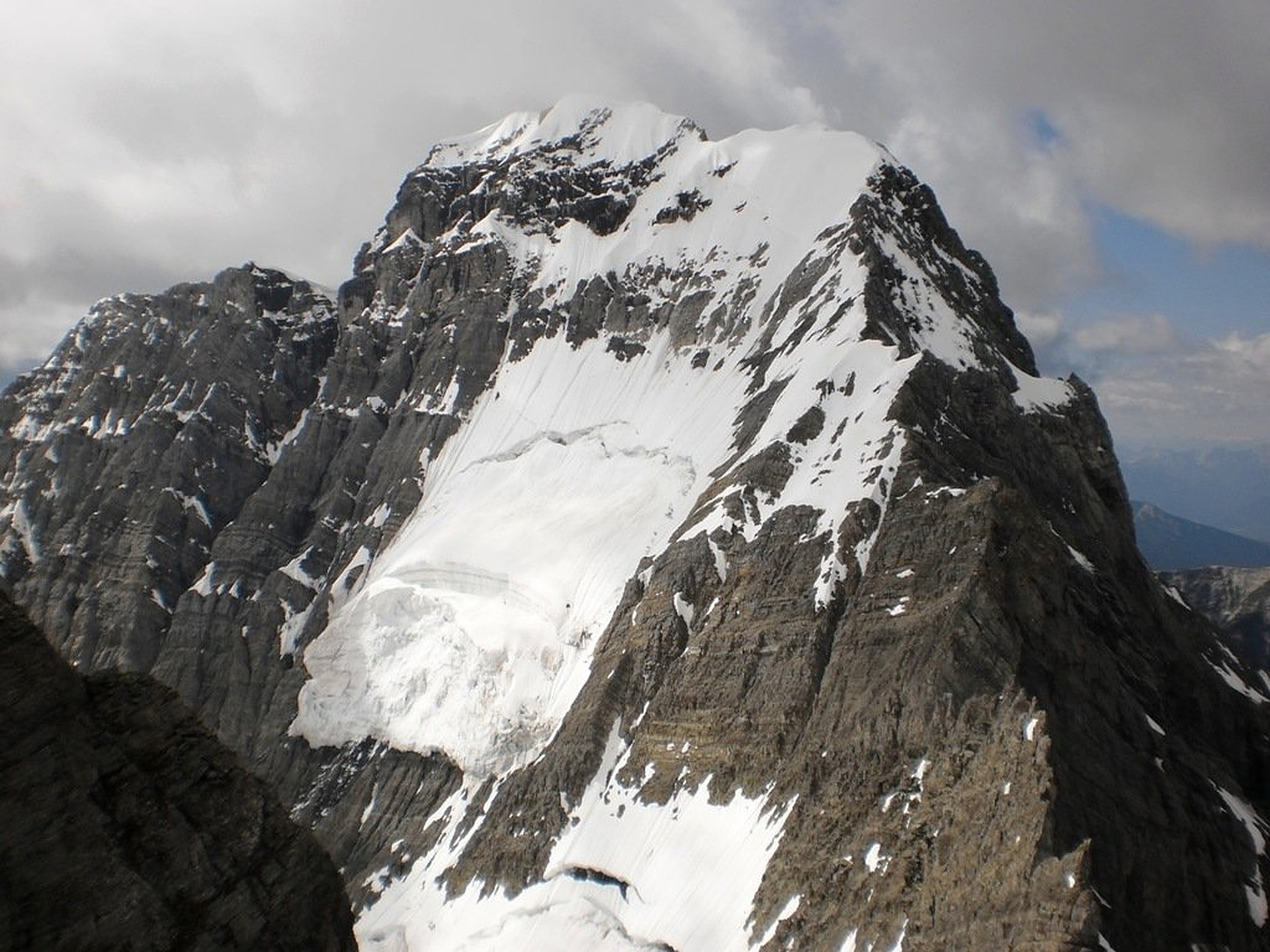
"Completed a solo climb of Mt. King George from July 27-29, 2019. There was a bit of rain on the Saturday hiking in but otherwise good weather throughout the trip. The hike to the meadows south of .Mt. Princess Mary was hard going with lots of deadfall on the route. The climb up the glacier was straight forward other than a bit of route finding to get across the rock ledges that lead to the glacier above the seracs." — MichaelDyck • Jul 28, 2019

"Skian Button had been scoping the Northeast Face of King George for years. A weather window broke in late March and we approached with food and fuel for four days. The Northeast Face breaks from the summit ridge. It's steep, with a couple of massive bergschrunds on top of a hanging glacier. We had scoped a gully beside the hanging glacier that we though would fill in with snow, and sure enough, it had. The descent was chalky, steep, and spectacular. The first descent was featured in the 2013 Canadian Alpine Journal. Here's the writeup from Biglines:
http://vault.biglines.com/articles/king-george-ne-face" — andrewskibird • Mar 31, 2013
Awards
Challenges
About peakery awards
Log successful summits on peakery to earn awards:
Peak Badges: Earn a special badge for each unique peak you summit. See all of your badges on your Badges page.

First Ascent Award: Only 1 available per peak. Goes to the first peakery member to log a successful summit of a peak. Snag this award and the peak will forever bear your name.

King of the Mountain Award: Only 1 available per peak. Summit a peak more times than any other member. Beware: this award can be lost!

Summit Steward: Summit a peak at least 5 times to become one of its Summit Stewards. As Steward of a peak, you’re encouraged to keep that peak’s info up-to-date on peakery and spread goodwill on your future climbs up the peak.