Region
Highlights
Routes
/-105.876073246016,35.6673502957225,11,0.00,0.00/320x240@2x?access_token=pk.eyJ1IjoicGVha2VyeSIsImEiOiJjampra3Z0bnAxeTVnM3FteHlybHY3b2p1In0.7a5dEa5-995VUv8ceHHNmw)
5 summits • 7.4 mi • 1,667 ft gain • 4 hr 11 min
4 summits • 8.5 mi • 2,467 ft gain • 4 hr 25 min
Latest summits

"I am in the process of hiking 5 peaks on 4 different hikes that don’t really want to hike, so that I can hike 4 peaks that are part of the highest 179 peaks in New Mexico. I joined the scout troop that I was in as a boy as an adult Scouter Reserve, Troop 166, so that I could hike 5 peaks on Philmont Scout land. Even though I am an Eagle Scout, Philmont would not give me permission to hike peaks on their land unless I was part of BSA. Last October I got one of those peaks. The troop asked me to condition the scouts for hiking before we hike the 4 peaks that I need in mid-September. If I get those 4, I will only be 2 short on my goal of the highest 179 peaks in New Mexico. We met in the northwest parking lot of Saint John’s College at 7:30 AM on Saturday, August 14, 2021 at the Atalaya Mountain Trailhead and were hiking by about 7:50 AM. To my surprise we had 18 people hiking, 9 scouts and 9 adults. I was excited about the numbers that we had because as I am nearing the end of my “goal peaks,” I am hoping to pass my love of peakbagging, backpacking, and camping on to others. The starting elevation was about 7,340 feet. The trail drops a little into an arroyo then heads up. We progres..." — Phil-Robinson • Aug 14, 2021

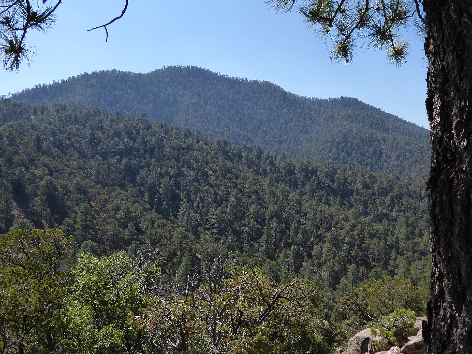
"This peak is easily accessible from the City of Santa Fe. Lots of trails in the area, most of which are signed. Three popular trailheads: St. John's TH, Dorothy Stewart TH and Wilderness Gate TH begin on or near St. John's College. I always use the Wilderness TH which is the closet to Atalaya Mountain. Problem is a small parking lot, only eight parking spots. If its full then just a 1/10 mile away is the Dorothy Stewart TH with four spots. If its full then you have to park at the St. John's TH which is about 7/10 mile further away. To get to these trailheads follow signs to St John's College (Old Santa Fe Trail to Camino Monte de Sol to Camino de Cruz Blanca). From the Wilderness Gate TH continue down the street (south) a short distance then east onto Camino de Cruz Blanca, into a gated residential area. Walk down the road for about a half mile to the forest service entrance. The Atalaya Trail is signed." — fredbrown585 • Oct 6, 2017

"Two humans and two dogs made and unplanned ascend on Atalaya Mountain and Atalaya Peak.
The weather was brilliant with only a few small cumulus here and there in the sky. We parked at St. John's College and walked down to the Arroyo, followed it a bit and then took trail 174, via the hard/difficult route, up to trail 170 and then to the top. The views are stunning - Bring a good camera because you have a lot of great photo ops. along the way. My favorite views were actually not over the city side but the other side. Endless untouched green landscapes of the Pecos Wilderness stretch out for many miles. In the distance you see a few Mesas and depending on the distance - The different faded shades of blue/green as the distance pales them. They look like they would be perfect to block print or cut-out into a piece of art.
This route starts easy, then easy/moderate, then moderate/difficult and towards the end it is easy/moderate again.
We did the hike in three hours. Two hours up and one hour down. Lovely, strenuous hike very close to Santa Fe." — saraculler • Mar 20, 2017

"I am not interested in lower elevation peaks in New Mexico, but peakery.com added a list called the Santa Fe Classics and I already had 17 of the 22, so I decided to get the remaining 5 of the classics, 3 today. This hike starts in Santa Fe. The trailhead is located in the NE corner of the Saint John's College parking lot. This is a wonderful, close hike for the Santa Fenans, but not as lush as the mountains directly north of the city. Horses, bikers and hikers are all welcome on the first 2 peaks.
I left my home at 5:15 AM, June 16, 2016, and was hiking by 6:30 AM. It was great to have a short drive! It was a cool morning, 49 degrees, and heated up later in the hike to the mid 80s. This would be a great hike in the early spring or late fall, middle summer can get a little hot. The starting elevation of the hike is 7316 feet, then drops a little to 7300 feet. There was a trail almost the entire hike, and after so many hard bushwhack hikes, it sure felt great. The only part of the hike that did not have a trail was the last push to the top of Sun Mountain. It was a hard 33 degree chug straight to the top. I followed the trail to the top of Atalaya Mountain through a beautiful fo..." — Phil-Robinson • Jun 16, 2016
Photos
Awards
Challenges
About peakery awards
Log successful summits on peakery to earn awards:
Peak Badges: Earn a special badge for each unique peak you summit. See all of your badges on your Badges page.

First Ascent Award: Only 1 available per peak. Goes to the first peakery member to log a successful summit of a peak. Snag this award and the peak will forever bear your name.

King of the Mountain Award: Only 1 available per peak. Summit a peak more times than any other member. Beware: this award can be lost!

Summit Steward: Summit a peak at least 5 times to become one of its Summit Stewards. As Steward of a peak, you’re encouraged to keep that peak’s info up-to-date on peakery and spread goodwill on your future climbs up the peak.